An 'Extras' Page: Los Angeles 1906;
"HAPPY TRAILS"
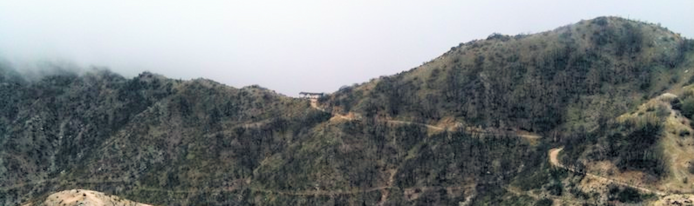
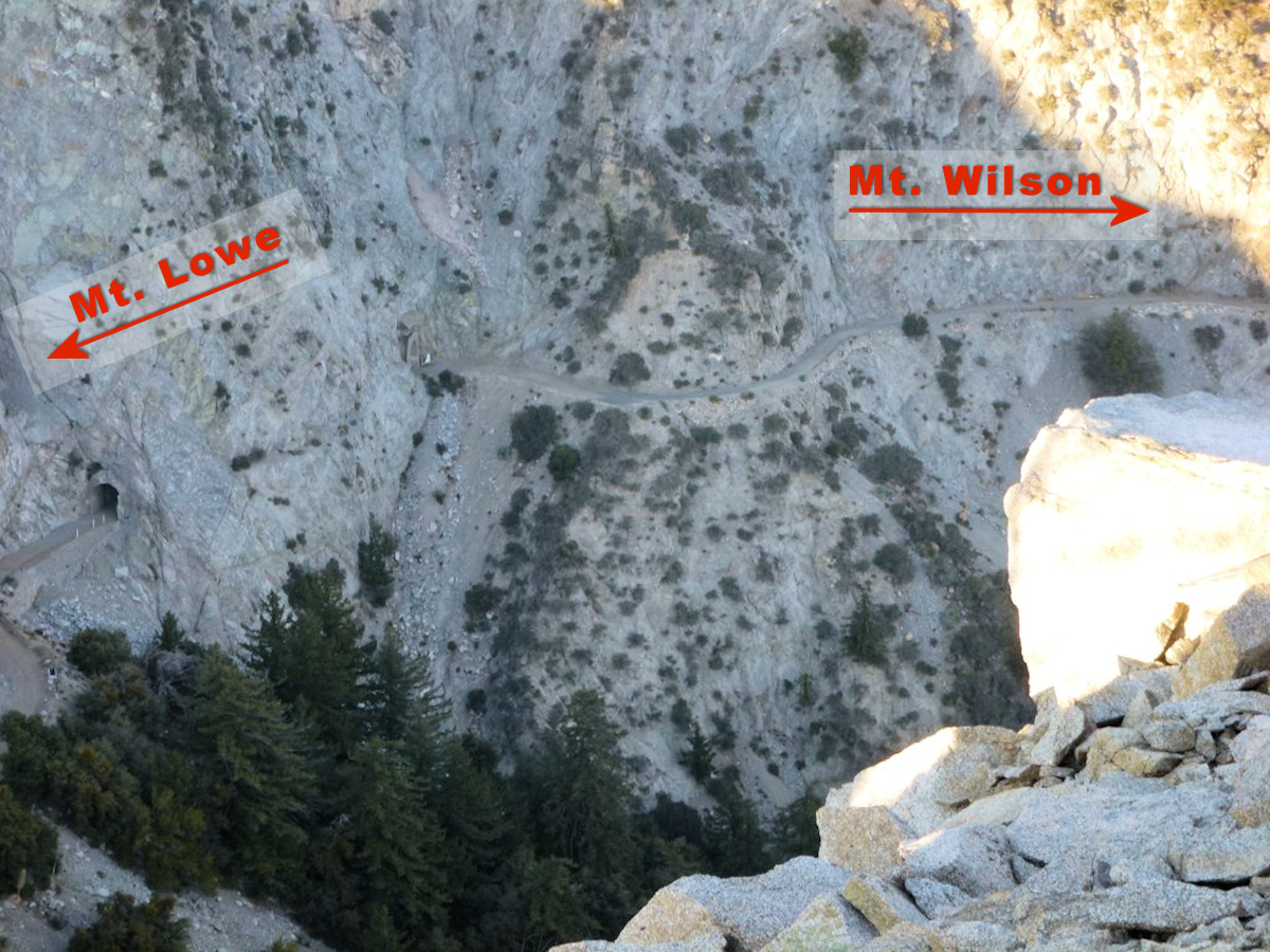
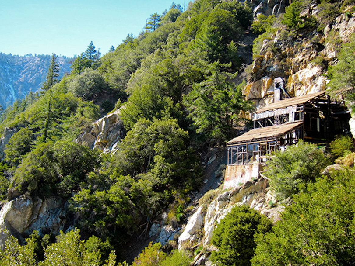
Muir Peak and Inspiration Point from Eaton Saddle today. You can see the Sam Merill trail leading to it from the alpine trail on Mt. Lowe
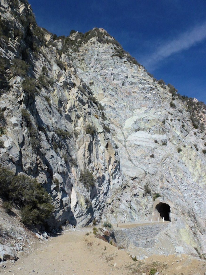
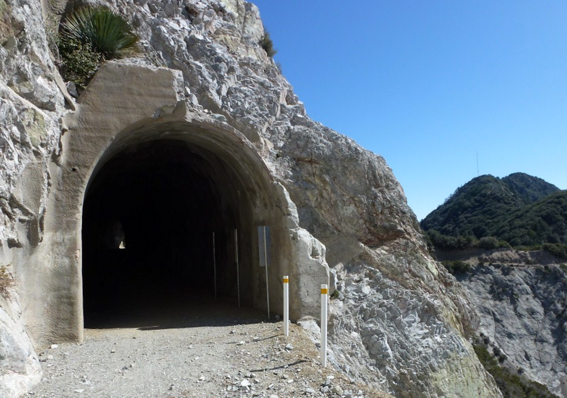
 Mueller Tunnel from the Mt. Lowe side.
From this vantage point one can get a
sense of how imposing the formation is.
EATON SADDLE PASSAGE: Trail or Tunnel?
Learning about Eaton Saddle was a Godsend. Particularly when you do not know what you are looking for and are unfamiliar with the area. It is no secret the mountains and hills of Los Angeles County are littered with trails. These trails are commonly seen on many of today's television shows and usually from San Vincente Park above the Getty Museum and Malibu Beach front. What is unclear from a strict television perspective are the canyons between these trails. This is no exaggeration, up until we discovered Eaton Saddle, Google Maps could not show us a route from the peak of Mt. Wilson to the peak of Mt. Peak under 36 miles. The peaks themselves are only a few miles apart from tip to tip! It was because Google would default to strictly roads, many of which are fire roads used only by the United States Forestry Service (USFS). However, selecting the hiker icon feature in Google Maps tells a different story.
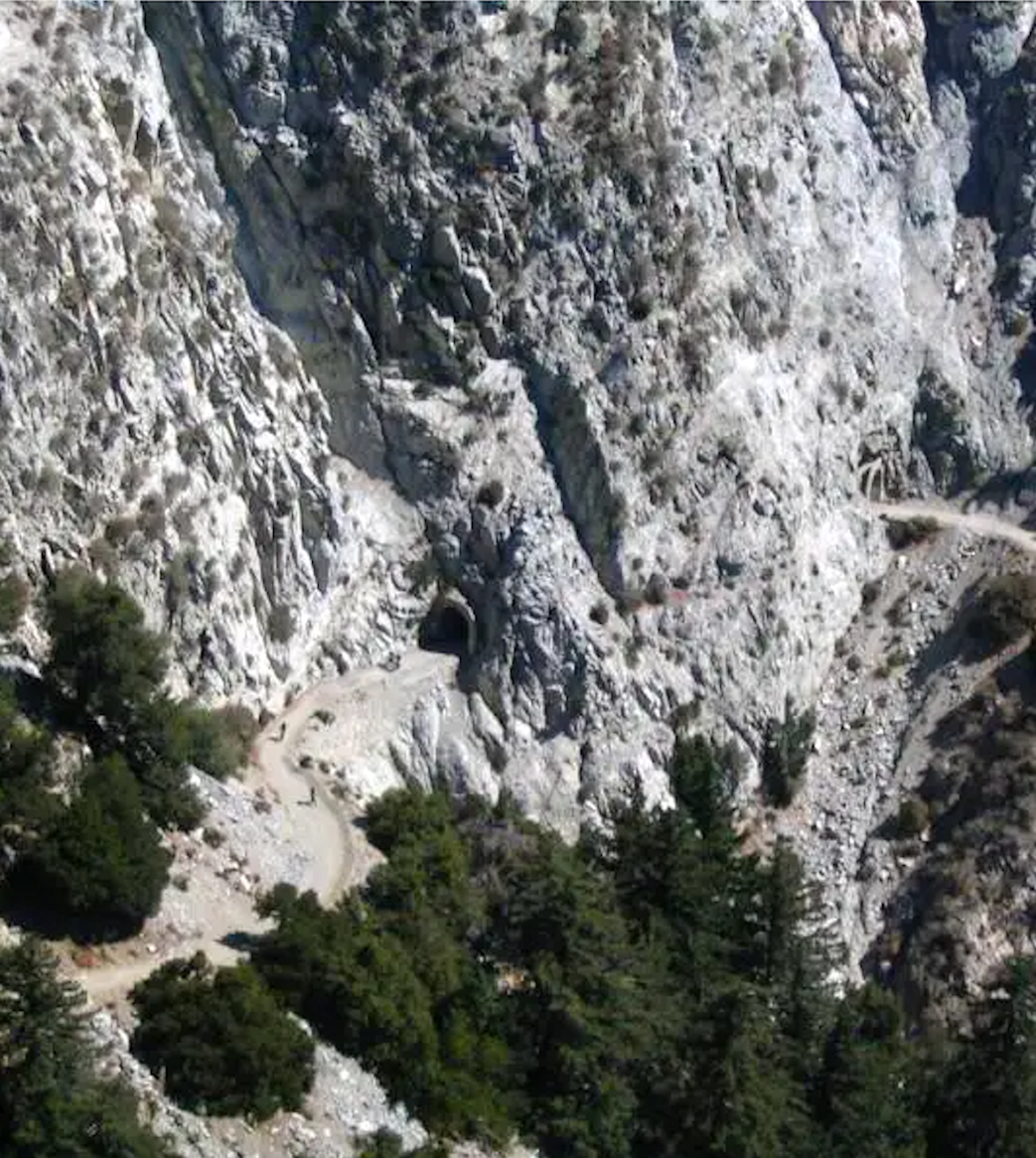
Mueller Tunnel from Mt. Markham
gives us a top-view perspective of the area.
Again, you can see how this formation juts
out and obstructs connecting a path.
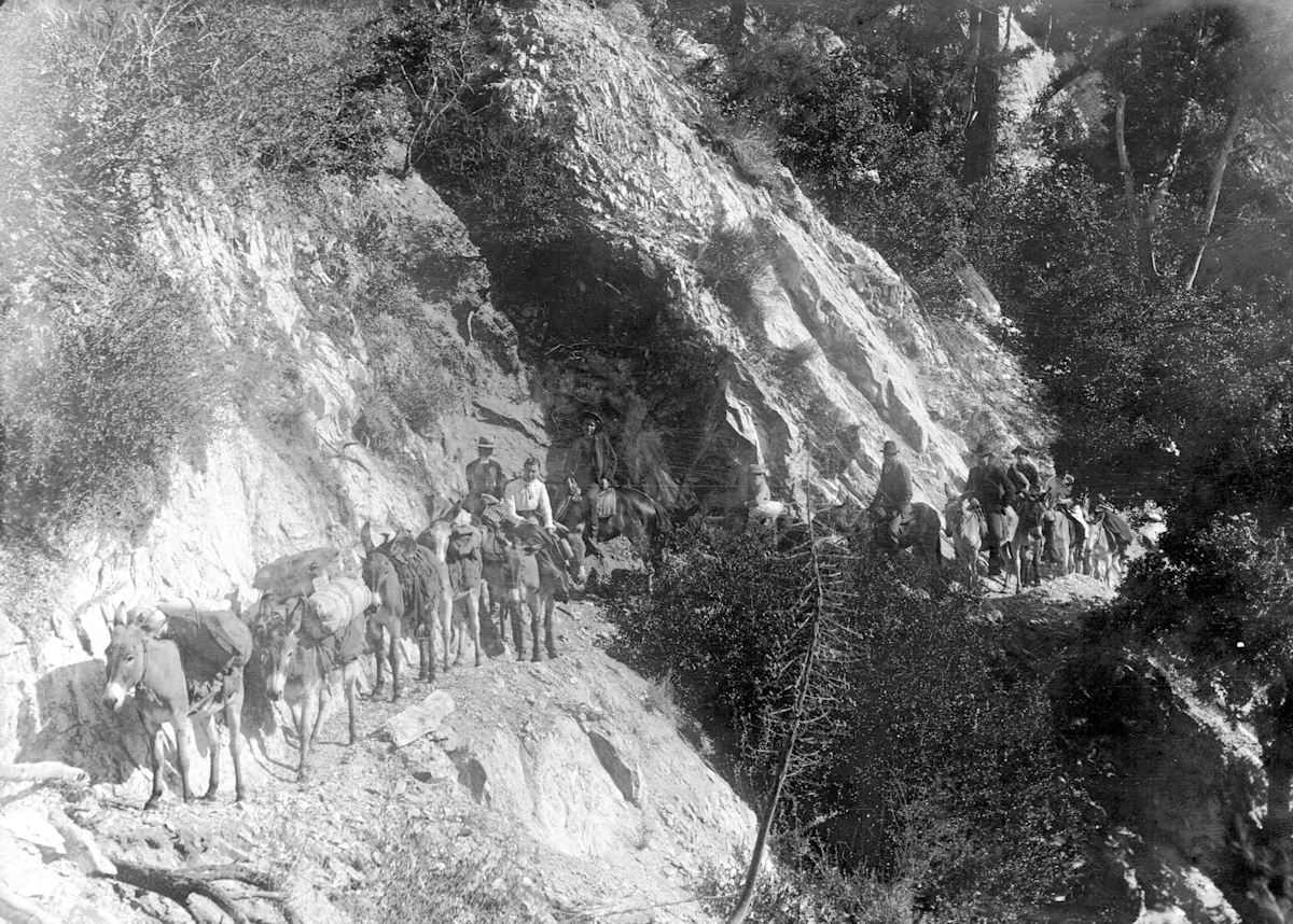
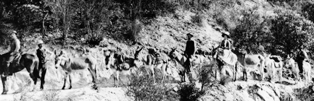
Eaton Saddle is the only passable way from Mt. Wilson to Mt. Lowe. We have no doubt Woodward and his friends passed through the saddle.
There is a clear, wide path cut across the saddle up until you get to this outcropping of solid granite in its middle on the southern face of San Gabriel. We know from the hikers' blogs about the area that there is a tunnel
(Mueller Tunnel) today connecting the paths from Mt. Lowe to Mt. Wilson. The question then becomes, was the tunnel there in the time young Rob and his two friends passed through the saddle?
Initially the assumption was yes. Mt. Lowe's developer Prof. Thaddeus Lowe plan always included continuing the railway from Mt. Lowe to Mt. Wilson and we know a path was excavated up to at least Eaton Saddle. Lowe's
initial plan was to develop Mt. Wilson but could not come to terms with the landowner. In many of the old maps and illustrations of the Alpine Railway show a path continuing past the last stop on the railway, Alpine Tavern.
By 1895, a combination of cash flow problems and his inability to make an adequate deal with the Mt. Wilson landowner (who Lowe continued to negotiate with while developing Mt. Lowe) forced Lowe to abandon the idea
of a railway to Mt. Wilson entirely. But, did he cut the path and tunnel up to the property line of Mt. Wilson before he lost his company in 1901?
Mueller Tunnel from the Mt. Lowe side.
An example of the dangers of falling rock.
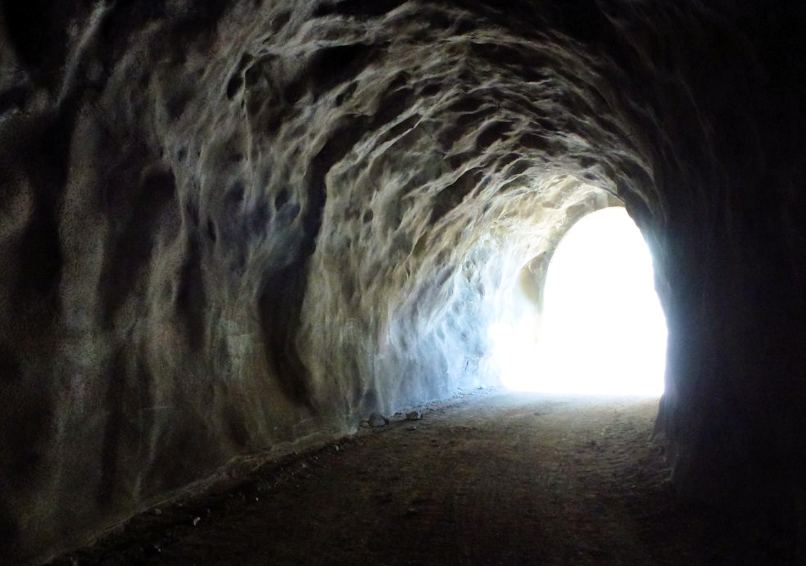
Inside Mueller Tunnel.
Here you can see the texture of inside.
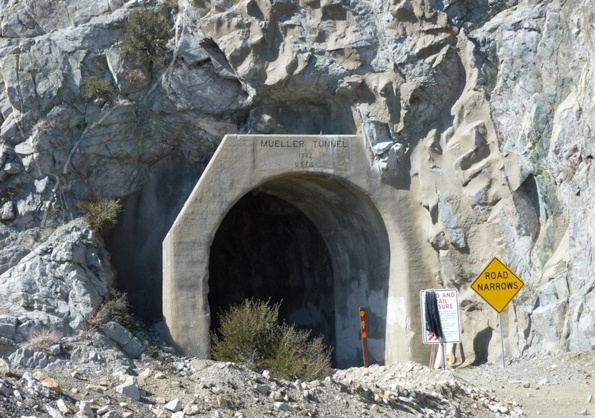
Mueller Tunnel from the Mt. Wilson side.
This image shows the name and date stamp.
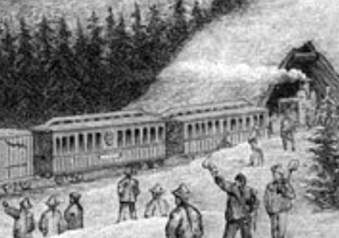
A current image of original masonry also seen in the Henry Ford produced silent film footage from
the Mt. Wilson side of the trail. Much of the visual evidence of the area suggests the tunnel is as old as
the trail. Unfortunately none of the online sources were able to comfirm what our eyes were telling us.
All of them, including the U.S. Forestry Service, claimed the tunnel was made in 1942. But then, we
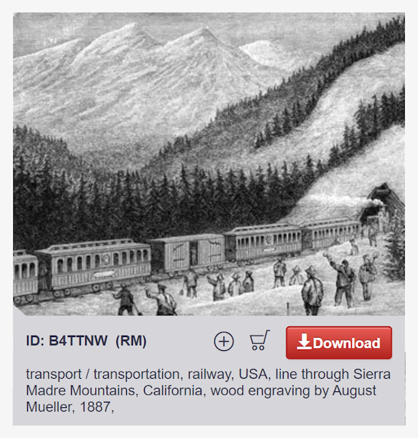
stumbled on a startling discovery of a 1887 etching by aritst August Mueller, the tunnel's namesake.
A capture from a 1887 etching made by
August Mueller. Compare the tunnel shape
with the picture above to see the simularities.
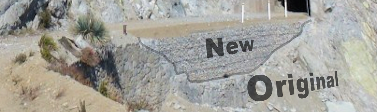
Mueller Tunnel from above, this time showing more of the
path to Mt. Wilson Road. The tunnel is actually an "L" shape.
You can see the open face of the Mt. Wilson side pointing
90 degrees differently from the Mt. Lowe side opening.
Every single source we can locate from blogs to the USFA cite Mueller Tunnel being either "finished" by the USFS in 1942 or made by the
USFS in 1942. Even renoun travel writer John W. Robertson makes no mention of the tunnel's origin in his book, "Trails of the Angeles: 100 Hikes in the San Gabriels." Not one source made a mention as to the
namesake of the tunnel or that the trails they were covering are made by Lowe. All of the old photograhs of the saddle's mule trail showed no tunnel. The tunnel was a mystery. For the most part, we believe the bloggers
are presuming the tunnel was made in 1942 because that is what the stamp-markings on the concrete abutments book-ending the openings of the tunnel. We believe the abutments were added to the tunnel as a
safety measure to protect further deterioration of the collapsing openings and from falling rocks. The tunnel today is used as a passage that is part of the fire road access veining throughout the entire San Gabriel
Mountain range once it became part of the national park sometime in 1940. This system of access roads, we have no doubt, were developed by the USFS that is their job.
Yet, and still, we do not believe
the USFS made the tunnel. Keep in mind, the railway operated until 1938. We believe the tunnel was already there, possibly in great disrepair, but it was there. The Forest Service may have made it wider for vehicles
like trucks. Repaired areas of the tunnel threatening to collapse and even replaced some of the masonry supporting the paths leading to and following the tunnel but the claim they cut the tunnel does not make sense.
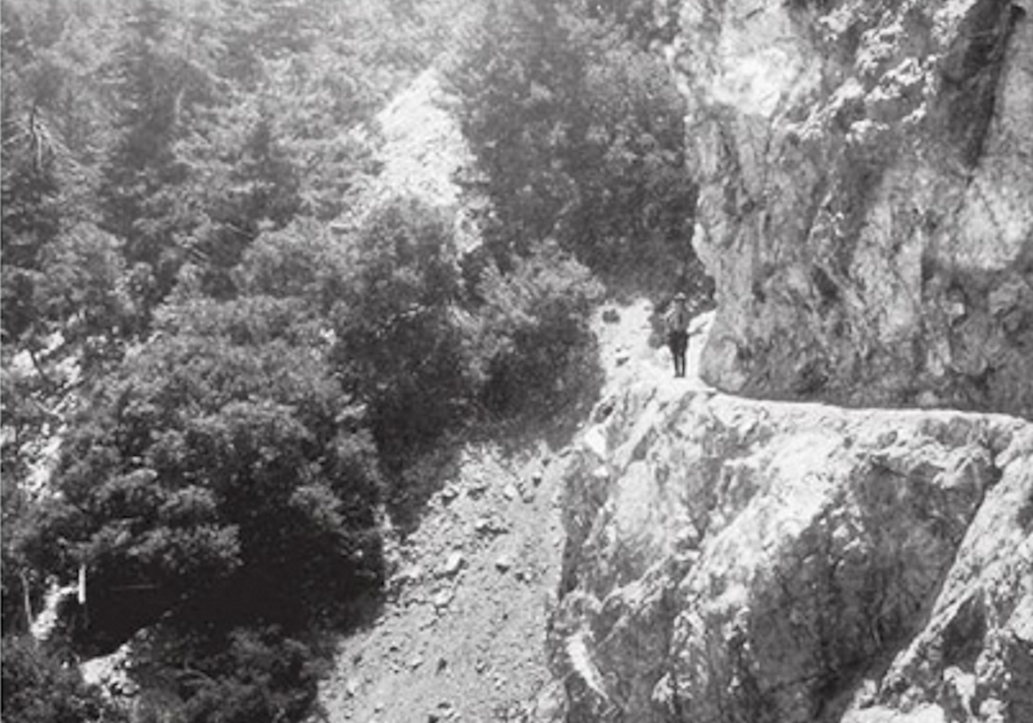
An undated image of a boy scout posing on the
Old Mule Trail linking Eaton Saddle with Mt. Markham.
Note the tunnel cannot be seen in this picture. We will
explain why later how this is not only the best
angle to capture the mule trail it is the only angle.
Enlarge to see graphic of tunnel location.
Unfortunately, we have been unable to support our claim. We could not find one single item proving the tunnel existed prior to 1942. Not
one single photograph of the tunnel, even from the 1940s, 50s or 60s. We could only find current images of the tunnel. All photos of the saddle prior to 1940 are of the mule trail. It is very possible the young men
simply took the mule trail and that would be fine with us. The truth is, how they passed through Eaton Saddle is not nearly as important as the fact they could pass through it. This is why we were not specific in our
story as to how they crossed the saddle. Some of the mule trails date back to the mid-1800s and the California Gold Rush. There is a mule trail that circumvents the tunnel (image to the right). It is narrow and
seemingly treacherous to pass especially at night. Today, the old mule trail has eroded so much it is very hard to see in pictures.
We were about to give up on the whole thing and leave it be. Then, as it
always does, just days from publishing this "Extras" webpage, we make an astounding discovery... again, by complete accident. We find an 1887 etching of the tunnel made by artist August Mueller in a stock photo
catalog displayed by the Google Images feature on a search, "Mueller Tunnel History." It amazes us how this image did not appear in any of our other dozen or so previous searches is beyond our grasp. Another Godsend.
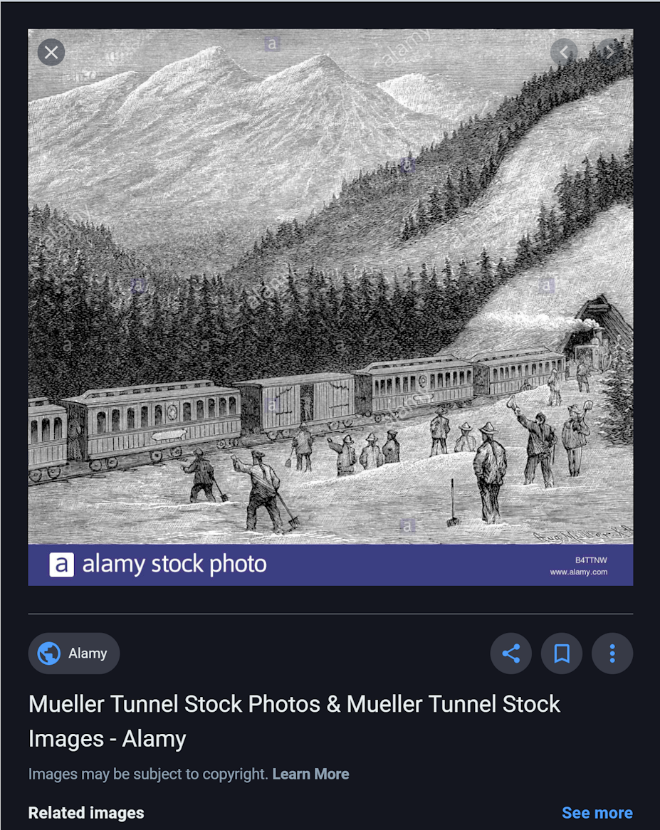
A screen capture of 1887 Mueller etching
from a Google image gallery. 1887 is the year
Prof. Lowe began funding his alpine railway.
Auspicious coincidence? We believe this may
be a rendering by the artist used by Lowe
to pitch to potential investors. Is Mueller
the tunnel's namesake? No one says...
which is even more amazing! How does no
one mention the artist or his work being
the origin and namesake of the tunnel?
Hovering over the stock image of
the Mueller etching gives us a year, however,
note it says "Sierra Madre Mountains." This
is not an error. The San Gabriel mtns of today
were originally named the Sierra Madres up to
1927. Both the trail and a town immediately
south of Eaton Canyon are named after
the original name of the mountains. The
etching matches the landscape of the Saddle
rock with Mt. Markham, Lowe and Inspiration
Point all lining up. Even the tunnel opening
appears to be similarly shaped to the final
product and placed in the identical postition
on the Mt. Wilson side which we believe
is the best and only photo-worthy side.
What always bothered us about the information that the USFS made the tunnel, prior to finding the etching, is the excavated paths on both
sides of the tunnel. They appear to be very similar to the paths the alpine rail ran along. They are wide and appear to be a similar width to the other trails. Then after wading through image after image we find a picture
of the tunnel that shows masonry work that appears very similar to the masonry work you can clearly see in the Ford Silent Picture footage of the ride up the railway to Alpine Tavern. Much of it today has fallen
away and the USFS has placed its own shoring to prevent the path from eroding.
Another annoyance was the inside of the tunnel. We only have pictures to provide us a look but the walls do not appear to
us to have been cut by relatively modern means. It appears, to us, to be hand tooled, chisels and picks. Sure, the USFS could have done this but in the 1940s, why? Here is the million dollar question that weighted on
us... Why would Prof. Lowe excavate the path from Mt. Lowe to Mt. Wilson and NOT cut a tunnel for the trolley cars (or even supply cars) to travel through the steep granite knoll blocking the path? A road up Mt. Wilson
(the very same one that passes Eaton Saddle today) was not built and finished until the year after in 1907. So how was the path excavated on the Mt. Wilson side of the pass without access from Mt. Wilson? It really
did not add up to us.
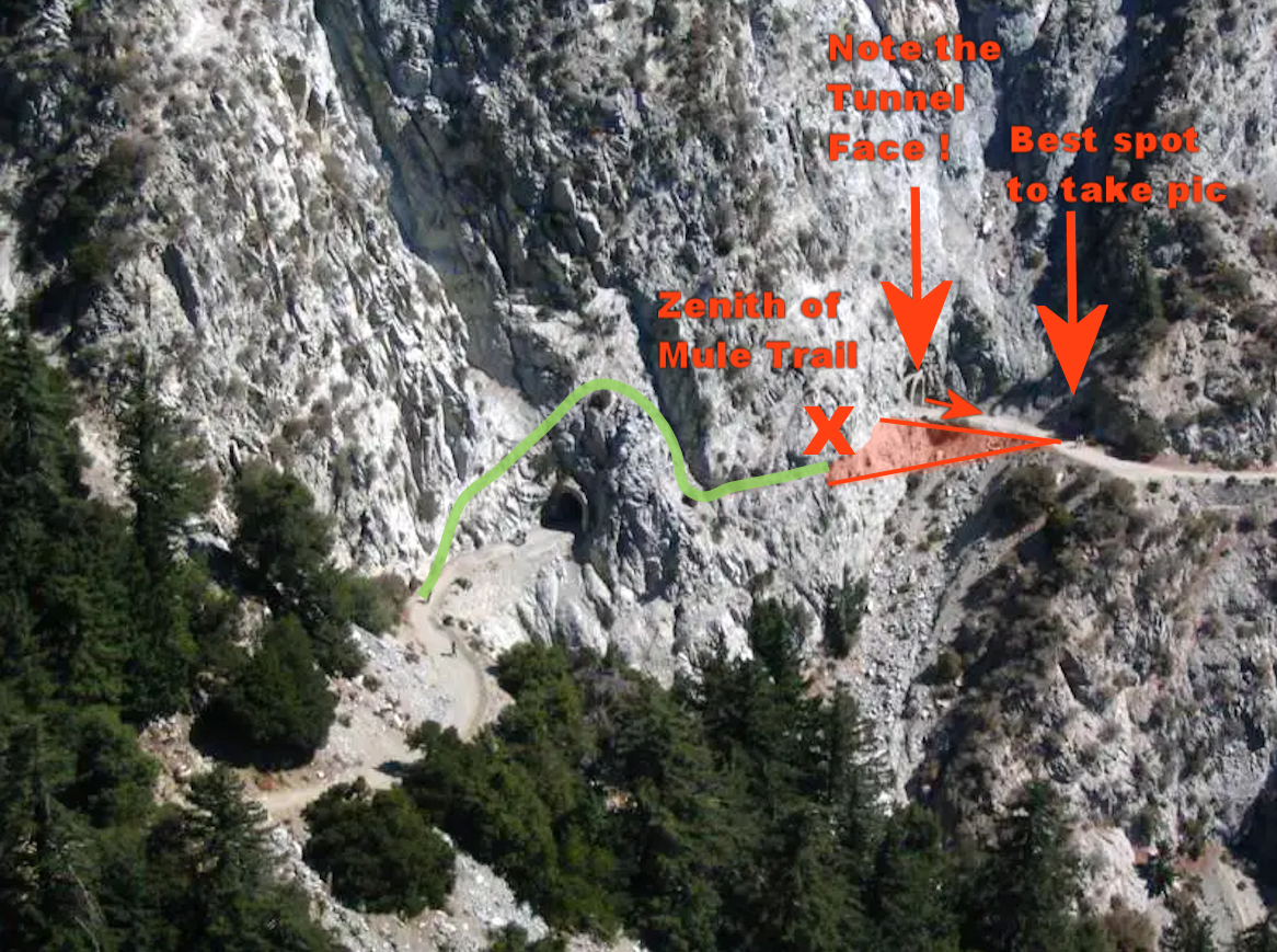
Mueller Tunnel from above, this time we added graphics
to illustrate how it is that the tunnel does not appear in any
pictures of Eaton Saddle prior to 1940. Because of landscape,
you cannot get both the tunnel and trail in the same picture
and the mule path is simply the more interesting photo op.
Studying all of the pictures we had of Mueller Tunnel to figure out why the tunnel does not appear in any of the photos taken of the area prior to 1940 and it becomes very clear. First of all, the tunnel is "L" shaped. It turns! Note from the image to the left. The Mt. Wilson opening of the tunnel is facing southeast. The path that follows continues in that direction and then begins to turn east towards Wilson. Also from the image to the left, we illustrate the mule trail's course in green. See how it goes above and over the Mt. Lowe opening. This means from the Mt. Lowe side you cannot even see the trail's edge. All of the pictures we found prior to 1940 are from the same spot - the Mt. Wilson side where the angle is most favorable. Note in our illustration how far from the Mt. Wilson opening is from the one place on the path to get the most optimal shot of the trail (review again the boy scout picture above). It appears that you cannot take an adequate picture of both the tunnel and trail together! This still does not answer why there are no pictures of the tunnel so we will offer you this explanation... It is a situation similar to today's social media trend, that "Instagram moment," is standing on a perilously narrow trail on the side of a cliff, not standing inside a safe tunnel. It is simply the more interesting shot to take. This is why we believe there are no pictures of the tunnel.
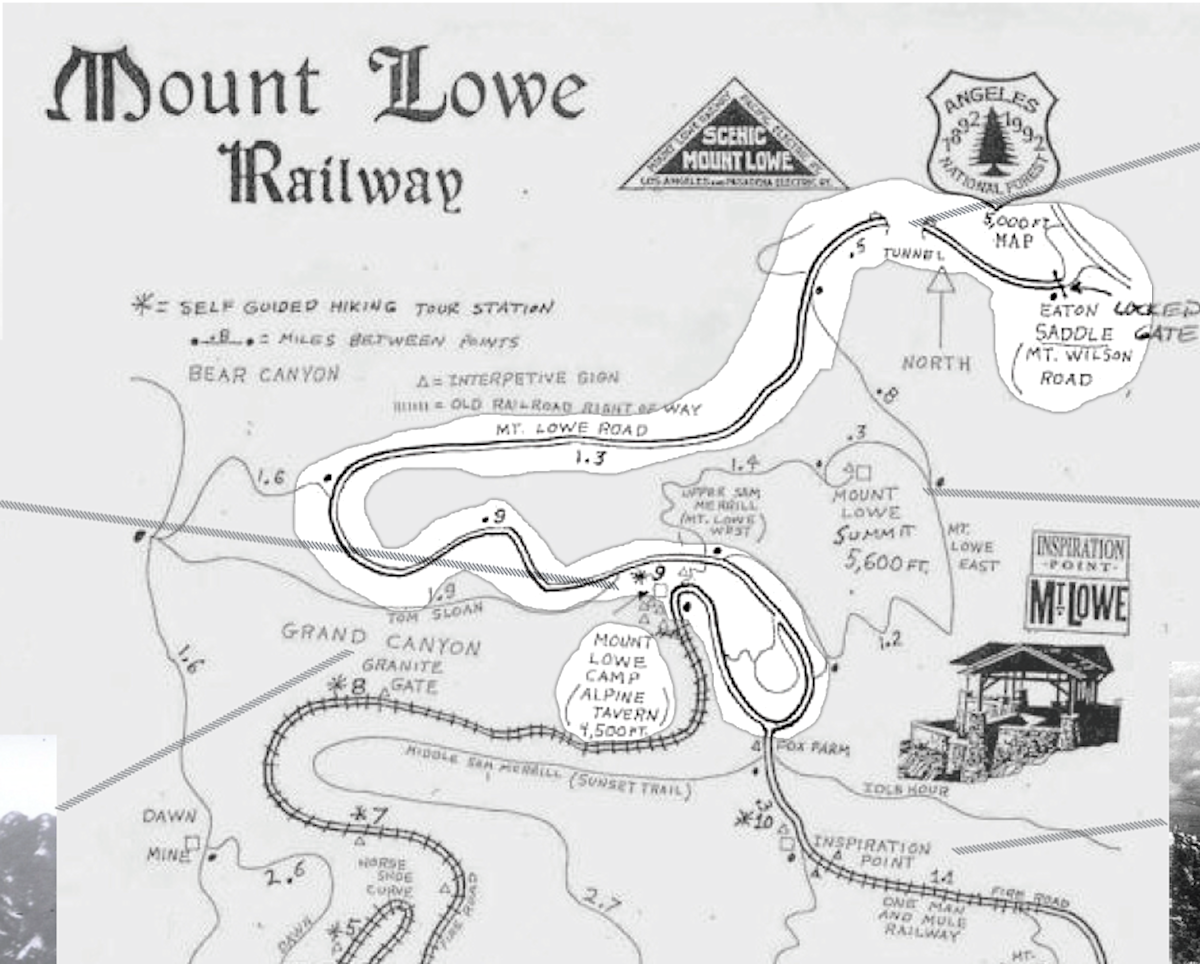
USFS area map from a brochure published in 1992.
The map is obviously older, in fact, it looks like a map made
by the Pacific Electric Railway and repurposed for the
100th anniverary of the United States Forestry Service.
Note the map clear demonstrates the path continuing
past the Alpine Tavern without track
The discovery of the etching made by an artist in 1887, the year Lowe began to raise money for the Alpine Railway venture, whose name, August Mueller, happens to be the namesake of the tunnel itself leads us to believe the tunnel was there when Woodward and his friends passed through Eaton Saddle the morning of September 3, 1906. Couple the etching with the masonry work visible in a silent film produced by Henry Ford matching the masonry work still visible today, old promotional maps made by Pacific Electric of Mt. Lowe showing a path continuing to Mt. Wilson and just simple and discerning logic has us past a mere coin toss as to whether Mueller Tunnel was made in 1942 or prior. It is our opinion it was made prior. Not one single source we read regarding Mueller Tunnel makes any mention of where the name came from, not even the USFS sources but this is beyond coincidence. The remaining doubt is the fact that Pacific Electric made a lot of upgrades and improvements to the railway after taking control in 1901 and ran the railway until 1938. It could very well be they added the tunnel sometime after Lowe lost control. Unfortunately, we could not find any details regarding this information. It still seems far more likely Lowe had the tunnel made since Mt. Wilson was always his long term goal. This does suggest the tunnel was availalbe to Woodward and his friends in 1906.
TO VIEW a PDF the full size version of the map above
( Page will open in a new tab)
Mueller Tunnel from the Mt. Wilson side used
above only this time we ask you note the shape of
the original opening and compare it to that of
Mueller etching. It is nearly identical to the artist
rendering - its triangular shape. View enlargement.
RELATED EXTERNAL LINKS
A photograph of the Sierra Madra Trail, Mt. Wilson
THE MULE TRAILS: Some History and Legend
The origins of the Sierra Madre Trail go back to the early 1800s with the arrival of the Spanish. The mountains were the main source of timber for San Gabriel Mission. The trails were the best access to the area. There was also a rich source of minerals in Southern California's Spainish-Mexican era prior to California becoming a state (1850). The first gold strike in California was in 1842 in Sutter's Mill near Sacremento. A number of years later gold was discovered in the San Gabriel's in Big Santa Anita Canyon northwest of Mt. Wilson drawing prospectors and mining operations who began to strip the hillsides. However, the San Gabriel Mountains never produced the riches of the central or northern California regions. Many of the mining operations failed and were abandoned but not without leaving its damage.
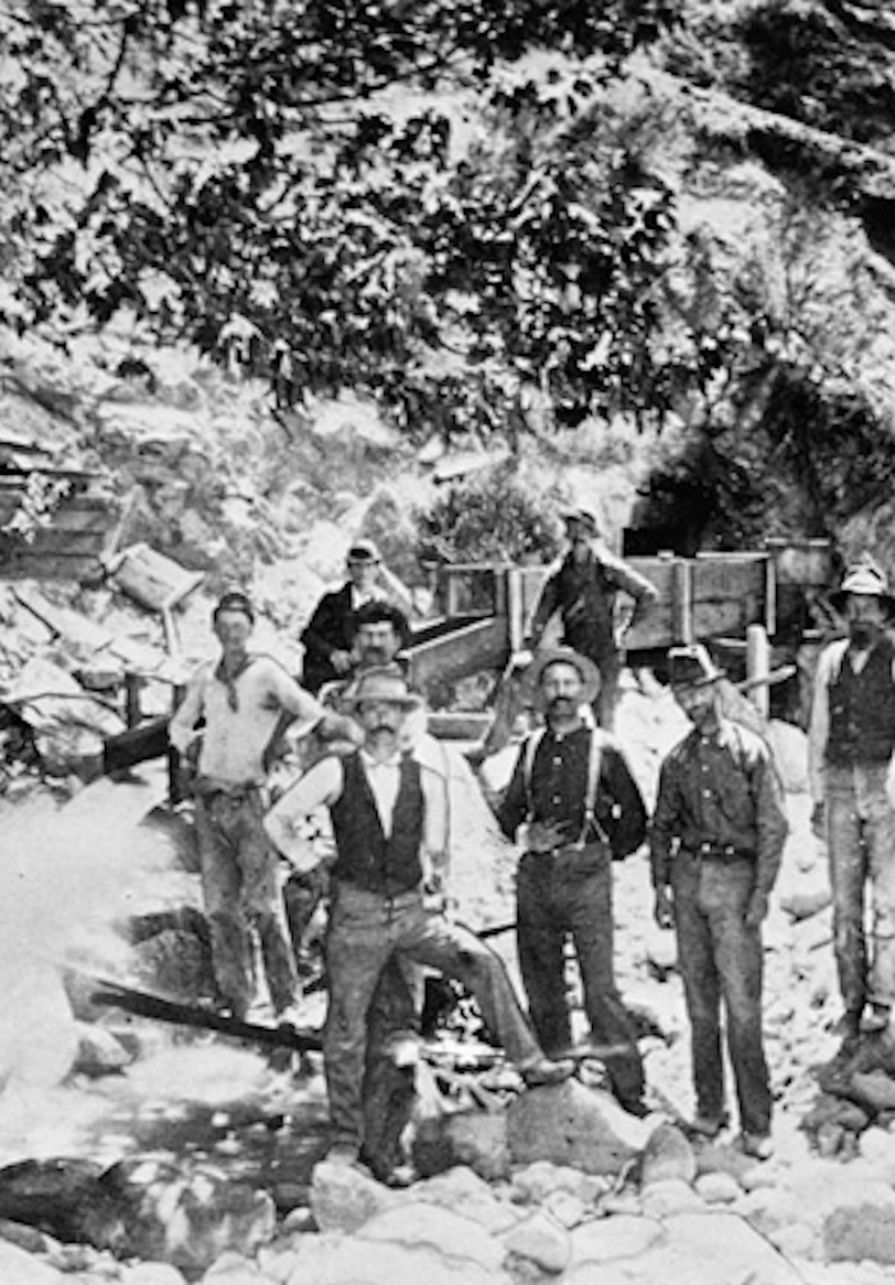
A photograph of a miners diverting
water while prospecting near Corvina 1885.
In the 1880s a movement began out of concern for the vanishing forest and the quality of the mountains natural resources, such as, its streams and springs, to preserve its natural beauty. California's first state forester, Abbot Kinney, in 1886 pleaded for the forest conservation. He was joined by famed naturist John Muir and other interested parties like the San Gabriel Valley farmers and orange growers. They eventually convinced President Benjamin Harrison in 1892 to create the San Gabriel Timberland Reserve. This would be the start of the Angeles National Forest. Still, if you note the years this is all coming together you will realize Thaddeus Lowe has already begun the development of his alpine railway (1887). This is not a coincidence.
Another growing trend of the time is the booming power industry and railways. America's growth is intimately tied to the railroad and power. Often it is was the power companies that built the railways, particularly the interurban railways (electric trolley systems). It is intrumental to urban development and the commuter culture. Along with connecting communities, these power/railway companies developed "amusement parks" and specific attractions to draw more riders. It is critical to their business model to get people in the habit of going on mini-adventures or what we would call today daytrips. To just simply travel. Urbanization also resulted in a nostalgia of sorts for the good old days of roughing it in nature and could be called a golden age of hiking. Yes, Victorian era Americans sought adventure and recreation, often way over dressed, but nonetheless it is the beginnings of the leisure culture. Burgeoning resorts were built in both the mountains and aside large bodies of water - lakes and oceans. While still other people went for the simplicity of another time camping in small cottages or tents.
A mule train bound for Arroyo Seco, circa 1905. The Photo Collection, Los Angeles Public Library. After the miners left and the Sierra Madre's now a protected
forest reserve. The Victorian Era public renewed its interest in connecting with nature forming hiking clubs and patroning mule ride services and tours.
It is this very sentiment that drew Woodward and his friends Victor and Fred to the mountains for a weekends of camping and adventure. The national movement of preservation and conservation would have an exceptionally strong influence on Woodward carrying over into his work as an artist and his personal style of homes and living. We thought it worthy of discussion. However, besides Woodward's desire to commune with nature, we also find it interesting that there are at least 3 abandon gold mines within a couple hour or so hike from where the three friends camped for the weekend. This is noteworthy because if you recall on The Accident webpage we discussed what Woodward would tell people about his accident when asked. One of those stories we mention is the one told by his Boston art dealer, S. Morton Vose...
"I am sure that you know, too, that his paralysis occurred when, as a student at college in California (I believe it was Leland Stanford) he and a friend were prospecting in the desert.
He carried a pistol (loaded) in his jacket pocket, and on becoming warm, took it off and threw it on the ground. The gun went off, severing his spinal cord."
CLICK HERE for more on the Vose Recollection
( Page will open in a new tab)
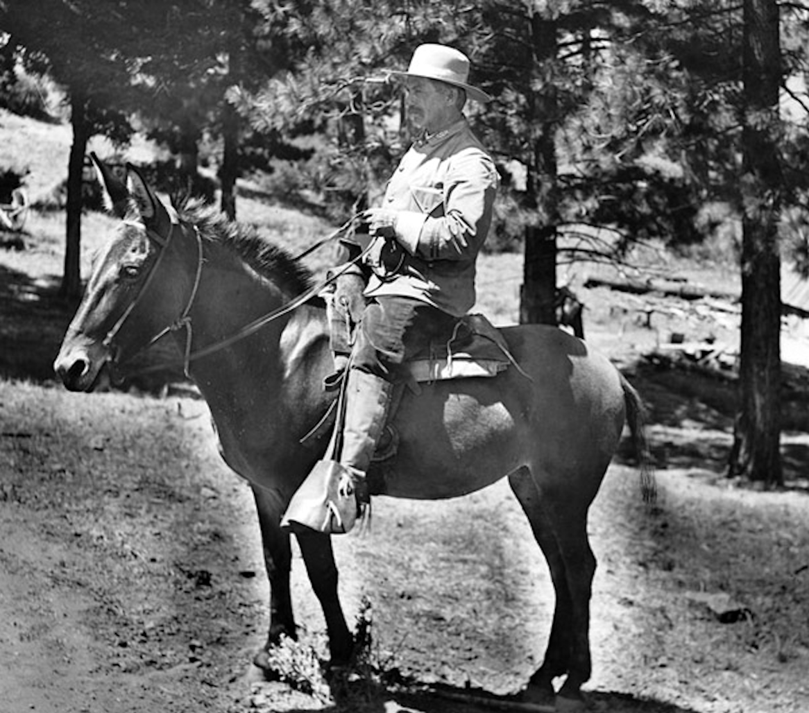
Mounted San Gabriel Timberland Reserve ranger, circa 1900.
We believe he is sitting on a mule. In the story linked below
a reporter decribes the ride options of tourist according to
height and weight between horse, mule and burro.
Our realization that there was gold mining and prospecting in the San Gabriel Mountains puts the story Woodward told Vose in a much different context. Is prospecting along the steams and rivers of the mountains one of the activities Woodward and his friends engaged themselves? Did they visit any of these old mines, particularly the ghost town of Eldoradoville? Hike the trail to Dawn Mine still popular today? We do not know. Woodward did tell Vose he was attending school. This is not true. Vose very well have misunderstood RSW or is mixing up two different stories. Woodward took a gap year to work for his father and earn some money (which we believe was actually to go to the Museum of Art School in Boston, not Stanford like his father wished). He was "on break" from school and there are gold mines in the area. It is not at all out of reach to believe he did go prospecting even if it was for jest. It makes his tail to Vose seem less ridiculous, with exception of how the accident occurred.
One last thing, the divergent histories of Mt. Lowe and Mt. Wilson are as contradictory as the forms of leisure people chose. Lowe is classically the resort
culture while Wilson is the traditional roughing it one. Perhaps this is why Prof. Lowe's original vision to develop Mt. Wilson never came to terms with the landowner of Mt. Wilson. It was a matter of differing ideaology. It could very
well be that the owner of Mt. Wilson did not wish to have fancy resorts sully the natural aesthetic of his rugged wilderness. Remember, Oak Mountain (Mt. Lowe's original name) was largely undeveloped while Mount Wilson was the
traditional and historic gateway to the Sierra Madre Mountains (the original name of the San Gabriels up to 1927). The boys rode up the lap of luxury and traveled back to the more traditional yet diminishing past of the way things
once were.
Classic Woodward!
READ this terrific article about a reporter's mule ride up Mt. Wilson published the day after RSW's accident
( Page will open in a new tab)
Big Horn Mine, Eldoradoville today. Photo credit: Daniel Medina
RELATED EXTERNAL LINKS
"EXTRAS" PAGES RELATED TO RSW'S 1906 ACCIDENT |
||||
Our Journey  AVAILABLE |
Happy Trails  CURRENT PAGE |
Chief Walter Auble AVAILABLE |
Parades & Festivals  COMING SOON |
Accident Page RETURN TO PAGE |
Selected Old Footage of the Mount Lowe Railway✽ ALL LINKS will open to a new tab in YouTube ✽ |
||
| TITLE & LINK | LENGTH | DESCRIPTION |
A Trip Up Mount Lowe With The Ford Camera Man" Mt. Lowe Railway & Funicular Pasadena 17324b |
8m : 21s |
Terrific original footage produced by Henry Ford of the climb up the electric alpine railway. It is an old-styled silent film! The film has its moments but because it is the original footage, is some what damaged. |
Mt. Lowe Railway - What Remains |
3m : 55s |
Produced by AOL (2012) in conjunction with the Mt. Lowe Preservation Society and the Pasadena Museum of History this short package provides good historical perspective and images. |
32m : 29s |
This lengthy video appears to have been an early made-for-television production on the railway found on VHS in the Pasadena Library archives. It uses a lot of the Ford footage with narration and organ music. |
|
4m : 07s |
A nice video of rare pictures accompanied by a nice folk-like song about the Mt. Lowe Railway by the Vin Fiz Flyer Bluegrass Band. The pictures are great and some are one's we've never seen before! |
|
Mount Lowe Railroad to Echo House |
5m : 14s |
This video feels like it was possibly made as a news package for the movies, like the Movietone News Reels. It uses Ford's original footage with voice over narration. |
1m : 11s |
Another short video that feels like a news package using the Ford footage and a narrator. |
|
There are also a number of terrific modern videos of the trails today... Use this link to see all the choices on YouTube. |
||