Quick Reference
c.1939
"Gandy" place over at
Dodge Corners in Hawley
Pastel on Board
Landscape
Purinton Hill, Landscapes & Views
22" x 29"
Southern Vermont AA, 1939
Springville (UT) Art Association, '41
Unknown
NA
.png)
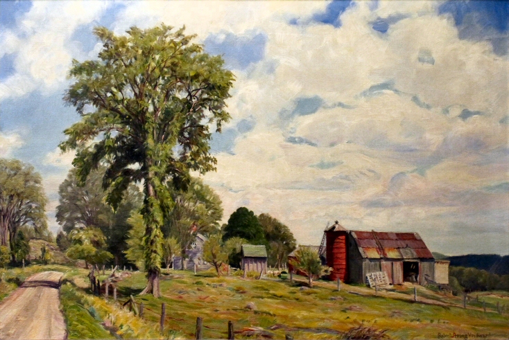
Featured Artwork: On a Mountain Farm
RSW's Diary Comments
734.png?url=photos/from_a_mountain_farm(21)734.png)
Painting Diary comments for - From a Mountain Farm:
"Painted in 1936. The present 'Gandy' place over at Dodge Corners in Hawley. Widely exhibited. Once at Springfield Museum in exhibition of noted Americana called Future Forefathers, in 1939. Bought in 1945 by Mrs. Roger R. Smith of 75 Elm Street, Gardner, Massachusetts."
Editor's Note:
It is obviously that this subject is special to Woodward. It is the subject he submitted to the Springfield Museum's "Future Forefather's of American Painting" exhibit in 1939 and was accepted. He was included in an impressive collection of works by some of America's best landscape painters. He then, also made this pastel and sent it to the Southern Vermont Artist Association AND to the International Art Show in Utah that still operates to this day. Then there is this painting for his friend F. Earl Williams, someone he trusted with his legacy. There is also a pretty thorough sketch below ⮟
Additional Notes
Below are two images. On the left is a sketch of the same scene in a mid-1930s sketch pad left by the artist and is in his collection. The other (on the right) is a F. Earl Williams picture of the oil canvas from the 1944 Smith Home exhibition.
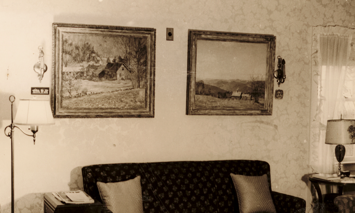
 An image of From a Mountain Farm hanging on
the wall of the Smith house with Portrait of a Shadow
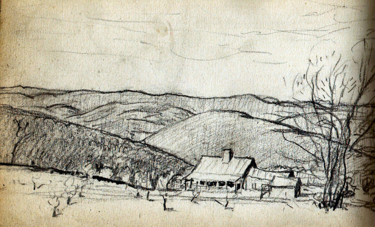
♦ It is not uncommon for Woodward to make both an oil painting and chalk drawing of a well liked scene. Only we suspect this chalk was made years after the oil.
As described in the diary comments above, the scene is from Dodge Corner Road in Hawley, MA, looking east toward Buckland. It is the most unique perspective of the hilly landscape of Buckland and it features all but three "hills" of Buckland. The most prominent is Hog Mountain just over the town line of Hawley behind the farm. To just give you an idea of just how high up Dodge Corner is from the distant hills you see. The 1927 topographical map below has Dodge Corner at an elevation of 1928ft. to Hog Mountain's 1621ft. peak. This height is how Woodward gets Hog, and Koochaug, a hint of Lone Tree Hill, as well as Drake Hill to the far right in the foreground. In the distance, al most straight ahead is Mary Lyon Hill flanked by Putt's Hill which shares a ridgeline, then Johnson Hill and Goodnow Hill behind it.A powerful image illustrating the essence of Buckland's geography.