Quick Reference
c. 1918
Ashfield, MA
Oil on Canvas
Landscape
Farms
27" x 30"
Stockbridge Public Library, 1920
Dr. Lawrence K. Lunt
N/A
Related Links
- See also the...
 Farms Gallery to view related pieces.
- See also the Scrapbook story relating to Dr. and Mrs. Lunt.
- See also the...
 Late Summer Gallery to view related pieces.
- See also September Peace (1933) for a related piece of work.
- See also the...
 Landscapes & Views Gallery to view related pieces.
- See our page devoted to...
 RSW confidante / friend Dr. Lawrence Lunt
- See also the...
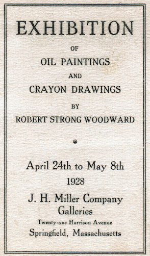 Exhibition List for a complete list of events
- See also the...
Farms Gallery to view related pieces.
- See also the...
Late Summer Gallery to view related pieces.
- See also the Landscapes & Views Gallery to view related pieces.
.png)
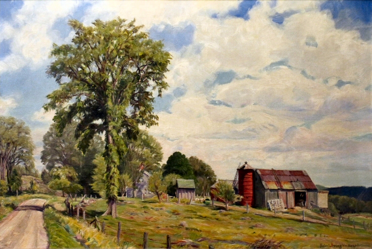
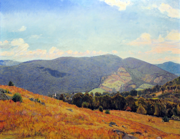
Featured Artwork: September Peace (1918)
734.png)
RSW's Diary Comments
hanging-on-wall.png?url=photos/september_peace(26)hanging-on-wall.png)
 September Peace hanging in its home.
• There is no entry for this painting in the painting diary, however, there is one for a painting by the same name in 1933. See below ⮟
From the Diary Entry for the 1933 Painting:
"Painted in early '33. A view on the "Brown Farm" (once owned by Uncle Bert) just off the Apple Valley Road. I made a smaller 27" x 30" of this same subject which went to J. H. Miller Co., Springfield, in a lot of a dozen canvases of mine they bought early in my oil-painting career. This larger canvas (36" x 42") was painted partially form the older canvas but also taken out to the farm itself to be worked on. Sold Nov.1947, through Earl Perry to Newton Savings Bank, Newton, Mass."
Editor's Notes:
The painting above is the 27" x 30" version of this same subject. It is also painted
similarly to another painting made in 1918 named A Buckland Farm
which we find very interesting.
Woodward's uncle Bert is Bert Wells, husband of his father's
sister Atella (Tella). It is their farm, the Pine Brook Farm, on Ashfield Road, where Woodward would
live for a brief period of time after leaving the Fine Art School, in Boston due to illness. It is
on their property, where an unused dairy shed along the roadside would be converted into Woodward's
first studio, Redgate. Continue below for more ⮟
Additional Notes
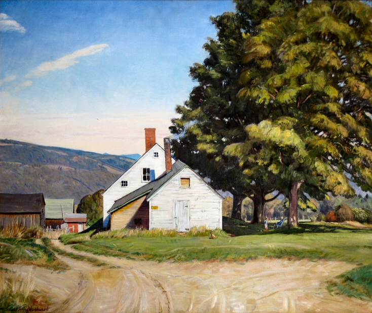
734.png?url=photos/buckland_farm(25)734.png)
A Buckland Farm, 1918: In both brush technique,
and color tones and hues, this painting is as similar
to the above canvas as any other we have seen.
From a type-written note attached to the back to the painting believed have been made by Dr. Lawrence Lunt:
"This picture was painted about 1919, and purchas-ed by us when we were resident at Middlesex School, 1919-20."
⮝ The handwritten part of the card is:
"'September Peace' - Farm house & cornfield in Western, Massachusetts"
An Excerpt from a letter by current owner:
"The date next to Woodward's signature on the front of the painting says 1918. There is an old card nailed to the back of the painting which does call it September Peace. The outside of the stretcher frame measures 27" x 30". Could it be the smaller painting to which the diary entry on the website refers..."
See the card below ⮟
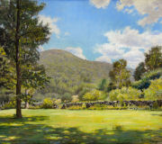
734.png?url=photos/an_old_farm(26)734.png)
An Old Farm, c. 1921 - We suspect that this
subject is from a similar perch near the painting above.
You can see the growth in his depth of color here.

A mimeograph copy of the card
attached to the back of the canvas.
Editor's Note:
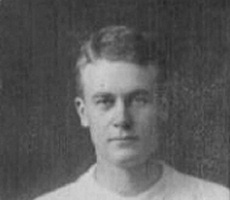
Woodward did not first pick up a brush to paint professionally until April of 1917 after trying to make a career as a commercial artist from rural Buckland. He first exhibited his work at the Boston Art Club and National Academy of Design in 1918 at the encouragement of noted artist Gardner Symons. Many of his earliest subjects appear to be from high up in Buckland. A Buckland Farm is high up on Putnam Hill (known locally as Putt's Hill) looking over the Clesson valley toward Purinton Hill (as seen in Winter Dignity), and another early painting that was also part of the wholesale lot sold to J.H. Miller in 1921, is New England Valley where Woodward sat himself high up on the Shelburne Falls side of Crittenden Hill looking towards Ashfield.
Bonus Material
Mary Lyon's Hill, 1935: This painting is from the
other side of town and the Wilder pasture on Purinton
Hill. Still, it clearly shows the twin peaks, one 200
feet lower than the other. This perspective is north
of Apple Valley Road which starts in Ashfield, MA.
Looking at this scene, as if for the first time, and noticing the hills in the distance...
It occurred to us that what we are looking at is the twin peaks of Mary Lyon Hill! We check out Google's
topographical map and sure enough, it was possible because Apple Valley Road does creep back into
Buckland, especially where it meets Cemetery Road. We cannot look up where Bert Wells previous farm
was located because there are no records prior to 1900 available online.
The problem is that
Apple Valley Road never goes high enough or is over far enough to see past Drake Hill. However, looking
at a topographical map from the time period where the elevations are clearly marked; Cemetery Road
climbs higher than Drake Hill and Mary Lyon Hill. According to this map, the highest point just off
Cemetery Road is 106ft higher than Drake and 30ft higher than Mary Lyon Hill.
When you take
that spot and draw a line to Mary Lyon Hill. It is a straight line point of view. In fact, looking
at the map below, the peak of Drake Hill is to the north indicating that the hill is a hundred or more
feet lower. The ridge line you see in the painting above is believed to be Ridge Hill on the Buckland-
Ashfield line. We will continue to investigate this information by going to the Franklin County
building in Greenfield to see if we can locate the exact property Bert Wells owned.
